The A-to-Zs of Central Oregon: N is for NEWBERRY CALDERA

Newberry-Volcano-Tours-Bend

Ah, that iconic image: The Newberry Caldera. This is the volcano that lies just 20 miles south of Bend! Did you know our little city was situated on the edge of a volcano the size of Rhode Island? And did you know that we lead daily Volcano Tours in the summer? It's a must-see when visiting Central Oregon. 

Newberry-Volcano-Tours-Oregon-Wanderlust
Hike-Newberry-Volcano-Bend

Is It Active?

The Newberry Volcano is technically still active, but there's been little cause for worry at this point. The US Geological Survey's Cascades Volcano Observatory have real-time monitoring systems in place, and they receive updates on any seismic activity, or changes in formations under and above ground. Thank goodness for scientists! 

The Volcano

This is an active volcano! The last eruption was only 1,300 years ago-- not that long ago in terms of volcanic history! 

Newberry Volcano is a shield-shaped stratovolcano, about 75 miles long, and 27 miles wide-- but when you factor in the lava flows, the caldera covers over 1,200 square miles! Because of its enormous size and prominence, the caldera is often confused for a full mountain range. 

This is the largest volcano in a series of volcanoes called the Cascade Volcanic Arc. This arc of volcanoes stretches over 700 miles, from British Columbia, through Washington and Oregon down to Northern California. These volcanoes were formed along the Cascadia subduction zone, which is the same convergent plate boundary scientists predict will cause the impending massive earthquake and subsequent tsunami dubbed "The Big One." 

Newberry-Tours-Bend-Oregon
Paulina-Lake-Canoe-Tours

The ground is lava! 

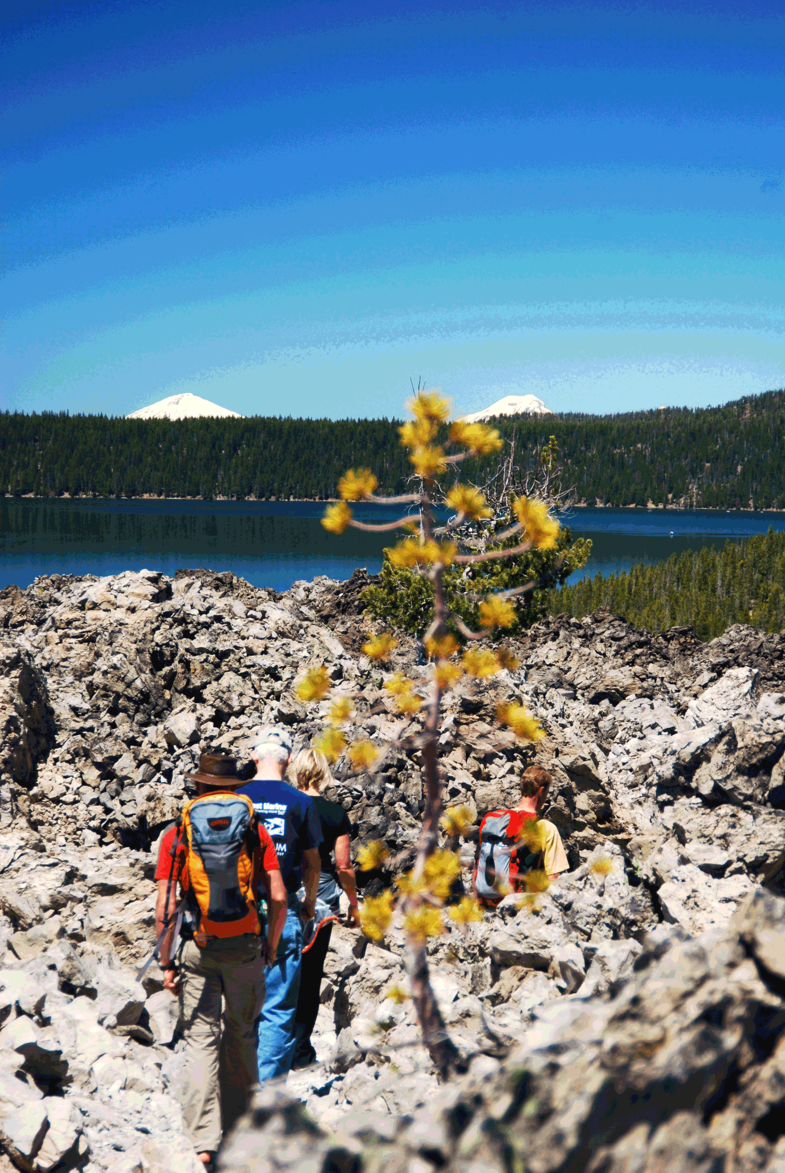
On our Volcano Tours, we make sure to take you through the amazing lava flows to highlight the power and scope of a volcanic eruption. You'll see shards of black, volcanic glass called "Obsidian," which we talked about in a previous blog post on our local geology. These gorgeous rocks have a smooth, glassy black surface that can be super sharp to the touch. They're quite a sight to behold. 

THE LAKES

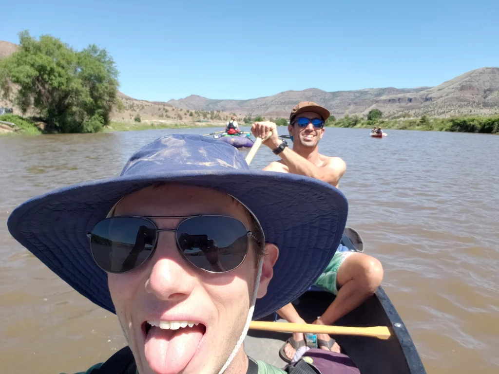
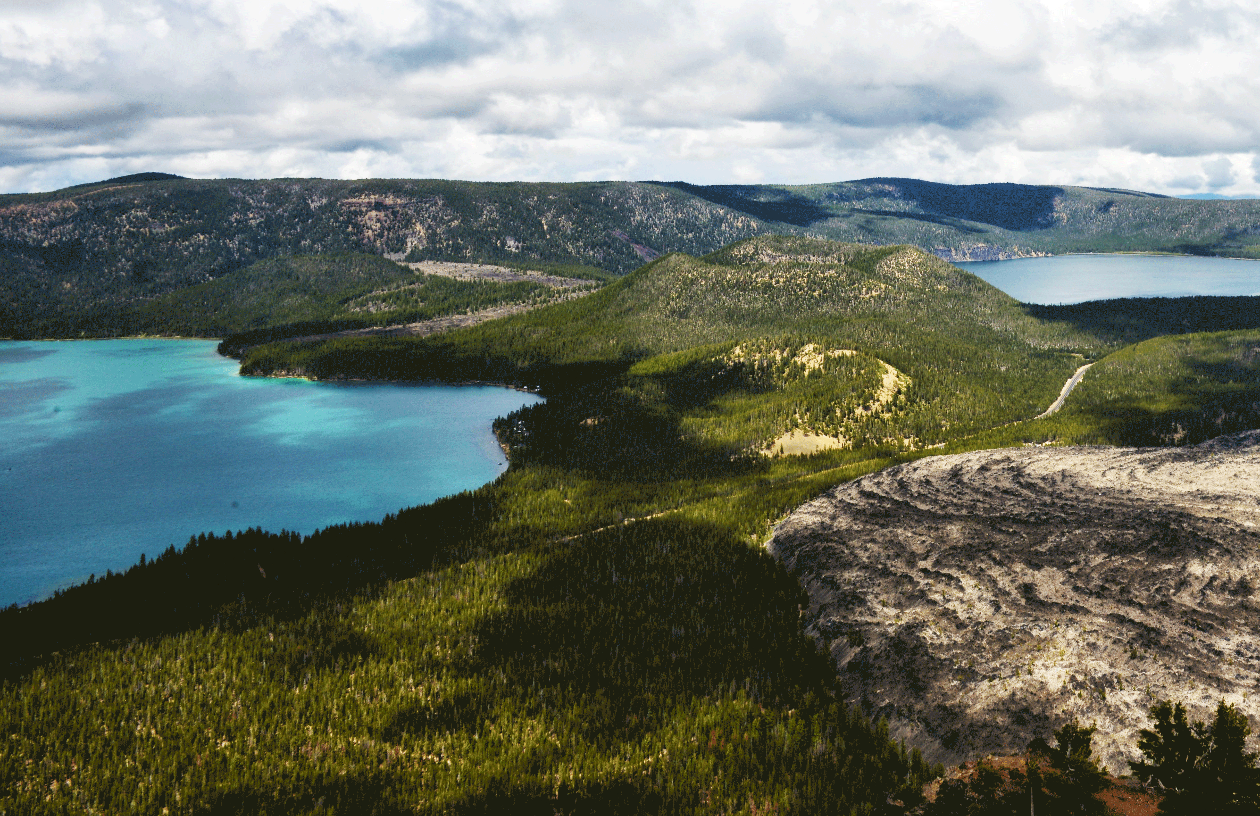
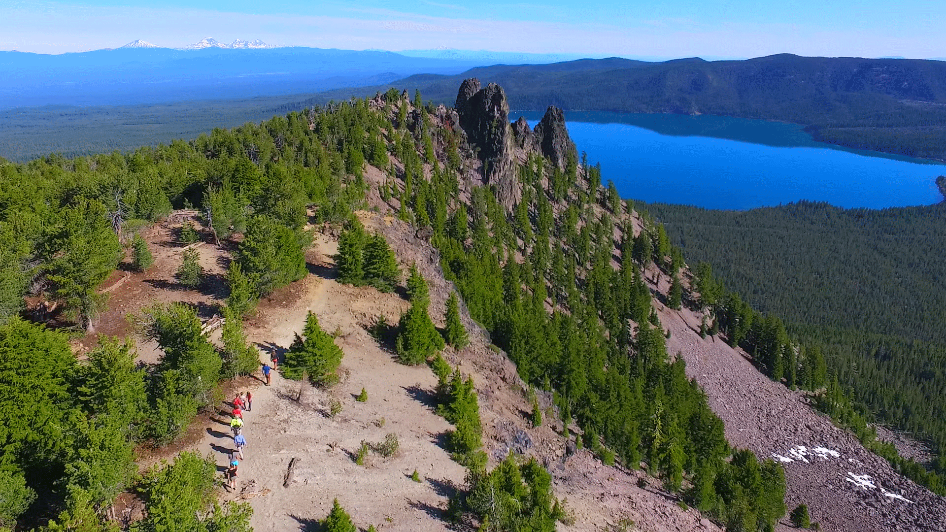
As if the volcano weren't stunning enough, there are two gorgeous crater lakes in the Newberry Volcano: Paulina and East Lake. We actually include Paulina in the possible lakes we visit for our Cascade Lakes Canoe and Kayak Tours. These lakes are filled only by precipitation, and percolation of ground water. Paulina is the larger of the two lakes at 1,530 acres and a depth of 250 feet, while East Lake is 1,050 acres and has a depth of 180 feet. The two lakes are separated by a narrow piece of land (or an "isthmus").

Obsidian-Volcano-Tours-Oregon

The A-to-Zs of Central Oregon: M is for MOUNT BACHELOR

We're back to our regularly-scheduled programming, with a very special entry of the Central Oregon A-to-Zs!

Photo by Chaney Swiney

Photo by Chaney Swiney

It would be remiss of us to discuss the wonders of Central Oregon without mentioning MOUNT BACHELORThis is one of the most popular destinations in Bend, in both summer and winter. The peak is easily visible from Bend, with its iconic flat top beckoning visitors and locals alike to come and explore! Luckily, this mountain is home to a world famous ski resort and endless recreational activities.

History 

Since its founding, the history of Bend has been directly linked to Mount Bachelor. The mountain was originally named Bachelor Butte, aptly named for the fact that it stands apart from the the Three Sisters mountains nearby. 

We talked about the rise of alpine skiing in a previous blog post, detailing how the Skyliners Ski Club were largely responsible for bringing the sport to Central Oregon. Bill Healy-- a member of this iconic ski club in the 1950s-- went on to found the Mount Bachelor ski resort we know and love today. His team decided that "Bachelor Butte" might seem too small-time to attract many skiers, and so they named the resort Mount Bachelor. It opened in 1958, and attracts hundreds of thousands of visitors each season to hike, ski, snowboard, snowshoe, snow tube, and even dogsled

Bill Healy overseeing early construction on Mount Bachelor. Courtesy of Snow Brains.

Bill Healy overseeing early construction on Mount Bachelor. Courtesy of Snow Brains.

Formation & Physical Attributes 

Mount Bachelor. Photo by Danny Walden.

Mount Bachelor. Photo by Danny Walden.

Sitting at 9,065 feet of elevation, Mount Bachelor is one of the crown jewels of the Central Cascade Mountains. The Cascades are a Volcanic Arc, meaning they formed as one tectonic plate was pushed under another in a process called subduction. The North American Plate (on top of which Mount Bachelor sits) is steadily moving northwest at a breakneck speed of 2 inches per year. As this happens, the much heavier Juan De Fuca Plate is pushed under it. This material melts into magma and rises to the surface, creating the Cascades. This is exactly what created the stratovolcano we now call Mount Bachelor about 15,000 years ago. 

Though not nearly as glaciated as other peaks in the High Cascades, Bachelor still bears scars of glaciers past. Most noticeably in the bowl located on the northern face of the peak, pinnacles of lava chambers remain where the rest has been worn away.

Want to explore the old growth Hemlock forest surrounding Mount Bachelor? We got you.

Want to explore the old growth Hemlock forest surrounding Mount Bachelor? We got you.

how to play responsibly

There's nothing better than zipping down a ski slope on a bluebird winter day or hiking to the top to see a beautiful summer view, but what can we do to make sure this mountain-- home to a wide variety of native plants and animals-- remains so clean and healthy? 

1. Stay on the trails!

This is a big one. We definitely understand to the temptation to go explore the woods-- that's why we've gone through the training, and attained necessary permits to do responsibly on our daily winter snowshoe tours. Mount Bachelor is surrounded by an amazing old-growth forest-- part of the immense Deschutes National Forest, which is over 2,400 square miles of protected forest area. Any time you happen to trample a plant, or disturb a nest, you're directly affecting the health of the forest! That's why we recommend heading out with us, rather than on your own. 

2. Keep it clean

Try to reduce the amount of waste you're bringing up to the mountain, and if you see some garbage-- pick it up! If you're a smoker, definitely wait to smoke at the lodge, rather than smoking out on the chairlifts or slopes. 

3. Carpool to the mountain

The easiest way to reduce your footprint is by reducing the amount of time you spend driving! Hop in a friend's car to head up to the mountain, bring your four friends along in your hatchback, or hop in one of our vans to enjoy a tour! 

4. STAY SAFE!

The best way to ensure that you protect Mount Bachelor is by protecting yourself. If you stay on the trails and protect yourself from injury by wearing the proper gear, then there will be no need for the mountain's rescue services to come to your aid! Mount Bachelor Resort has designed everything perfectly so that you might enjoy the benefits of the mountain, without needing to put yourself or other in danger. So, enjoy!

Summer 2018 Wanderlust Tours Staff Outing: John Day River!

We're pretty lucky to be able to explore all the amazing wonders of Oregon. That's why we try to explore something new each season for our staff outing. Sometimes we even turn our staff outings into custom tours for corporate groups, family reunions, bachelor/bachelorette events, or other group outings! This one was pretty amazing, and we were lucky to witness some stunning scenery. 

All photos by Danny Walden

All photos by Danny Walden

Last week we had an amazing three days canoeing the John Day River! We're lucky to love what we do, but it's also nice to set aside time away from work to hang out together. We set aside a couple of days each season for an outing, and for our Summer 2018 Staff Outing, we set out for three days of canoeing out on the water. 

John-Day-Canoe-Trip-Wanderlust-Tours

The John Day River is a tributary to the Columbia River. It's about 284 miles long, and is the third longest free-flowing river in the continental United States. It's one of the few undammed rivers in Oregon, and flows through some pretty amazing desert landscapes. 

Did we mention we love to hang out together? 

Naturalist Guides Danny & Nick paddling

Naturalist Guides Danny & Nick paddling

Naturalist Guides Erika & Jason enjoying some delicious Crux on the hilltop!

Naturalist Guides Erika & Jason enjoying some delicious Crux on the hilltop!

Naturalist Guide Courtney plays ball

Naturalist Guide Courtney plays ball

Naturalist Guides Julie and Jared make a great paddling team!

Naturalist Guides Julie and Jared make a great paddling team!

The River

John-Day-River-Oregon
Canoeing-John-Day

We took our trusty canoes out on the water and experienced the perfect blend of weather. We enjoyed beautiful sunshine on the first and second days and dramatic clouds on the horizon for the third day. 

Office Assistant/Naturalist Guide Phenix leads the way

Office Assistant/Naturalist Guide Phenix leads the way

Sharky-Wanderlust-Tours

Sometimes the river got the best of us, but luckily we had some personal flotation devices handy (thanks, Sharky!). 

Moonlight-John-Day-River
We had a visitor at our campsite on the last morning!

We had a visitor at our campsite on the last morning!

Our two campsites were amazing. We set up our tents among the fields of sage dotting the landscape, taking in the stunning hillsides all around us. On the first night, we saw a dramatic moonrise over the mountain across the river. 

John-Day-Fossils-Bed-Tours-Wanderlust

We also stopped at the John Day Fossil Beds. These are the amazing Painted Hills of Eastern Oregon, with their signature stripes of red, black, and grey in the golden sand dunes. We had a great time! If you think you might be interested in bringing a group to the John Day River or the Fossil Beds, reach out to our Group Coordinator to get started!